Ares to Hectares Converter
- Last formula update:

Decimal & Rounding Policy
- Calculations use the exact relationship 1 hectare = 100 ares, so conversions are performed with full internal precision.
- Values are not rounded during intermediate calculations, helping preserve accuracy when converting between area units.
- Displayed results may be rounded to a practical number of significant digits while keeping the underlying calculation unchanged.
- Very small or very large results may be shown in scientific notation to keep values clear, readable, and precise.
Valid range
- Are (a): Accepts positive finite values greater than 0, provided the equivalent area remains within the supported calculation range.
- Hectare (ha): Accepts positive finite values greater than 0 using the exact relationship 1 ha = 100 a.
- Other area units: Values are valid when their converted base area is between 1e-18 m² and 1e24 m².
- Zero, negative values, non-numeric entries, non-finite numbers, and values outside the supported range are rejected.

Felovyn Quarnwick
Reviewers:
Meravie Quellmont
Herixon Vosswick
Check our editorial policy
September 6, 2026
1.0.0
Initial calculator and formula release.
Our engineers are here to help you get it right.
How Does the Ares to Hectares Converter Work and What Should You Know?
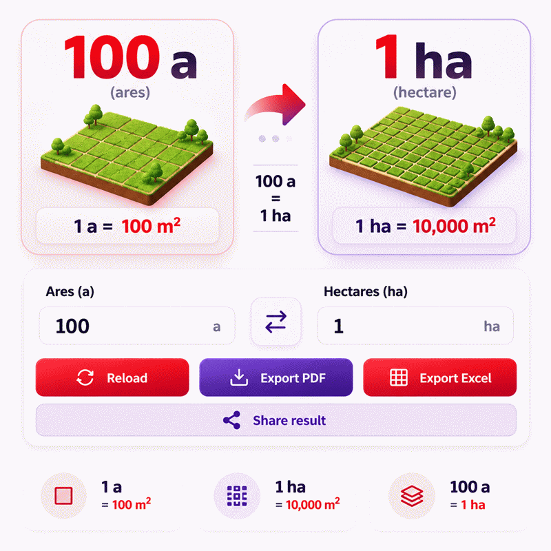
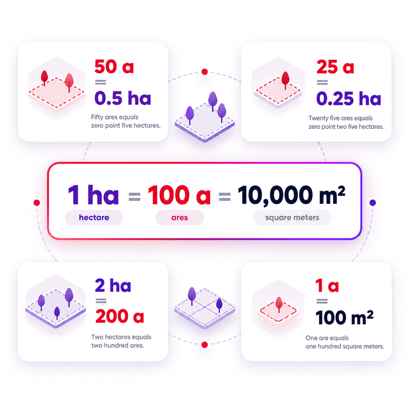
Ares to Hectares Converter calculations use the exact relationship between these two metric land-area units. One hectare equals 100 ares, while one are equals 100 square meters. The calculator keeps the physical land area unchanged and only changes the unit used to express it. It also supports reverse conversion, so a known hectare value can be converted back into ares without rebuilding the calculation.
- 1 hectare equals exactly 100 ares.
- 1 are equals exactly 100 square meters.
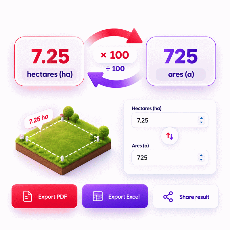
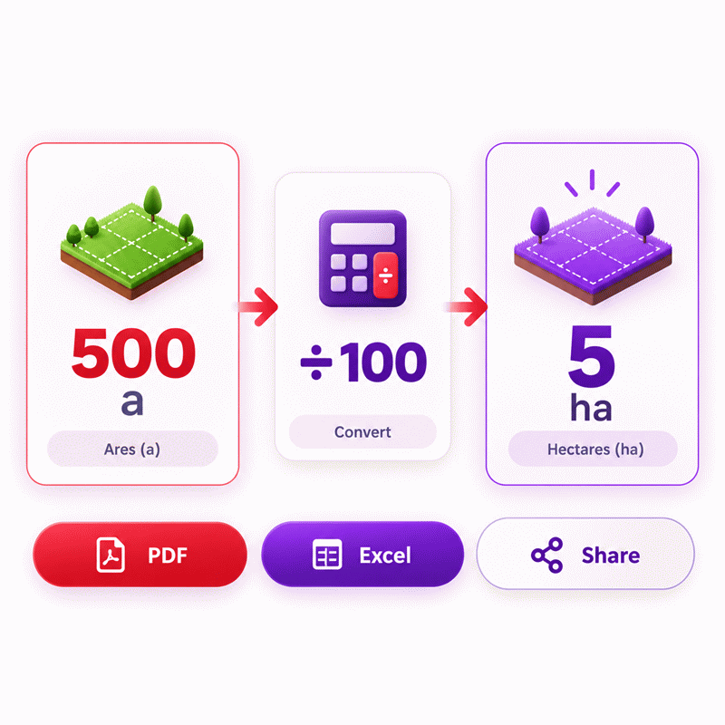
- Converting ares to hectares reduces the numerical value by a factor of 100.
- Converting hectares to ares increases the numerical value by a factor of 100.
- The same physical area remains unchanged during every unit conversion.
- Ares are practical for smaller land parcels and local property measurements.
- Hectares are easier to read for farms, forests, estates, and larger properties.
- Reverse conversion helps when land records already provide the area in hectares.
- Different survey or GIS values may reflect measurement differences, not conversion errors.
- Always confirm the original number and unit before using a converted land value.
The Ares to Hectares Converter helps users compare land records, property sizes, agricultural areas, and mapping data quickly while keeping each result clear and easy to verify.
Assumptions used in this calculator
- All area conversions use exact standard unit relationships.
- One hectare is assumed to equal exactly 100 ares.
- One are is assumed to equal exactly 100 square meters.
- Square meters are used as the common internal calculation base.
- Intermediate calculations are performed without intentional rounding.
- Displayed values may be rounded only for readability.
- All entered values are assumed to represent positive physical areas.
- Selected units are assumed to match the intended area measurement.
- International definitions are used for foot, yard, acre, and mile.
- Legacy survey-unit definitions are not used in this calculator.
- Results assume accurate source measurements and correctly entered values.
- Industrial users should verify critical dimensions against project specifications.
- Legal or cadastral decisions should use officially certified survey data.
Results are rounded for display.
Internal calculations use full precision.
Formulas Used in Ares to Hectares Converter :
1. Convert the Entered Area to the Base Unit
The entered area is first converted to square meters without intermediate rounding.
2. Convert the Base Area to the Selected Result Unit
Because every editable field uses the same base area, the same calculation works in either direction, including ares to hectares and hectares to ares.
Variables
- Am2 = physical area expressed in square meters.
- xu = numeric value entered in the selected source unit.
- ku = square-meter conversion factor for the selected source unit.
- xv = calculated value in the selected result unit.
- kv = square-meter conversion factor for the selected result unit.
Area Conversion Factors Used by the Calculator
| Unit | Symbol | Square-Meter Factor |
|---|---|---|
| Are | a | 100 m2 |
| Hectare | ha | 10,000 m2 |
| Square meter | m2 | 1 m2 |
| Square kilometer | km2 | 1,000,000 m2 |
| Acre | ac | 4,046.8564224 m2 |
| Square foot | ft2 | 0.09290304 m2 |
| Square yard | yd2 | 0.83612736 m2 |
| Square mile | mi2 | 2,589,988.110336 m2 |
| Square centimeter | cm2 | 0.0001 m2 |
| Square millimeter | mm2 | 0.000001 m2 |
The primary relationship is exact: 1 hectare = 100 ares. Intermediate calculations retain full available precision, and rounding is applied only when a result is formatted for display.
Variables & Definitions
View a complete list of all variables used in this calculator, including definitions and units
Ares to Hectares Converter Variables and Calculation Parameters
| Variable | Meaning | Unit | Role in Calculation |
|---|---|---|---|
| Am2 | Physical area expressed in the calculator's base area unit | m² | Stores the common base area used for all forward and reverse conversions. |
| xu | Numeric value entered in the selected source area unit | Selected area unit | Acts as the editable source value that is converted to the base area. |
| ku | Square-meter conversion factor for the selected source unit | m² per selected source unit | Converts the entered source value into the common square-meter base area. |
| xv | Calculated numeric value in the selected result area unit | Selected result unit | Represents the converted result obtained from the common base area. |
| kv | Square-meter conversion factor for the selected result unit | m² per selected result unit | Converts the common square-meter base area into the selected result unit. |
Unit Conversion Table
Ares to Hectares Complete Unit Conversion Table
| Unit Group | Unit Name | Symbol | Equivalent in Hectares | Used For |
|---|---|---|---|---|
| Popular Units | Are | a | 1 a = 0.01 ha | Land parcels, property measurement, and metric land records |
| Popular Units | Hectare | ha | 1 ha = 1 ha | Agriculture, forestry, surveying, and large land areas |
| Popular Units | Acre | ac | 1 ac = 0.40468564224 ha | Agriculture, real estate, land surveying, and property measurement |
| Popular Units | Square Foot | ft² | 1 ft² = 0.000009290304 ha | Buildings, floor plans, real estate, and construction areas |
| Popular Units | Square Yard | yd² | 1 yd² = 0.000083612736 ha | Landscaping, yards, property sites, and construction areas |
| Popular Units | Square Mile | mi² | 1 mi² = 258.9988110336 ha | Geography, regional planning, mapping, and large territories |
| Scientific Units | Square Meter | m² | 1 m² = 0.0001 ha | Engineering, construction, property, and metric area calculations |
| Scientific Units | Square Kilometer | km² | 1 km² = 100 ha | Regional mapping, geography, environmental studies, and large areas |
| Scientific Units | Square Centimeter | cm² | 1 cm² = 0.00000001 ha | Small surfaces, laboratory work, and technical measurements |
| Scientific Units | Square Millimeter | mm² | 1 mm² = 0.0000000001 ha | Engineering, manufacturing, design, and very small surface areas |
Example Calculation
A parcel of 3,275 ares is equal to 32.75 hectares. The conversion is exact because one hectare equals 100 ares. No intermediate rounding is required for this calculation. The same relationship can also be used in reverse by multiplying hectares by 100.
When hectares are entered instead of ares, the calculator solves the conversion in reverse automatically. Since one hectare equals exactly 100 ares, 47.36 hectares converts to 4,736 ares. The physical area remains unchanged while only its numerical representation and unit change. No intermediate rounding is required for this conversion.
Results are rounded for display.
Internal calculations use full precision.
Calculations Disclaimer
How to Convert Ares to Hectares Accurately
A land value can look simple and still cause costly confusion. The Ares to Hectares Converter removes that friction immediately. The Ares to Hectares Converter also keeps the land size unchanged. Only the unit used to describe that area changes.
An are is a metric area unit used for land measurement. One are represents one hundred square meters. A hectare is a larger metric land unit. One hectare contains one hundred ares. It also represents ten thousand square meters.
This relationship makes the conversion direct and easy to understand. A smaller numerical hectare value represents the same physical land area. Nothing is added to the property. Nothing is removed from it.
What Changes When Ares Become Hectares?
The number changes because the hectare is a larger unit. Imagine measuring the same road in meters and kilometers. The road does not shrink when kilometers are used. Only the numerical scale changes.
The same idea applies to land area. A parcel described with many ares needs fewer hectares. This is useful for farms, estates, forests, and development sites. It also makes large area values easier to read.
Consider a property description containing several thousand ares. That figure may feel harder to compare quickly. Expressing the same land in hectares creates a cleaner reference. It can also make reports easier to scan.
Why Scale Matters in Land Records
Choosing a sensible unit reduces mental effort. Smaller parcels may be easier to understand in ares. Larger parcels often read more clearly in hectares. The best unit depends on the size and context.
This matters when several properties appear in one report. Different units can hide important size differences. A consistent unit makes comparison much faster.
Property buyers can also misread a listing when units change. A large number may appear impressive without proper context. Converting every parcel to one unit exposes the real difference.
Land size stays fixed → Unit scale changes → Number changes → Meaning stays identical
That sequence is the key idea behind reliable area conversion. The tool does not estimate the land itself. It converts a known area into another compatible area unit.
For daily use, this saves time and reduces mental arithmetic. For professional use, it creates a cleaner comparison workflow. A clear result also helps when information must be shared quickly.
Quick check: always identify the unit beside the original number first. That single habit prevents many conversion errors before they begin.
How Reverse Ares and Hectares Conversion Works
A common problem appears when the known value is already in hectares. Many basic converters expect ares as the starting value. That creates unnecessary work for the user.
A bidirectional converter removes this limitation. The known field can become the starting point. Other compatible area values then update from that same physical area.
This is useful when documents use different measurement systems. One file may show hectares. Another may show ares. A mapping platform may show square meters. The land itself remains unchanged throughout the process.
When Hectares Are the Starting Point
Hectares often appear in agricultural records and large property listings. They are also common in forestry and regional planning. A user may need the matching value in ares.
Reverse conversion should not require rebuilding the calculation manually. The hectare value can serve as the known quantity. The equivalent number of ares can then be shown directly.
This also supports comparison between older and newer documents. Historical records may use one land unit. Current records may use another. A reversible tool helps connect both descriptions.
The same benefit appears during international property research. Different countries may favor different area units. A buyer can normalize those values before making comparisons.
Why Bidirectional Editing Reduces Mistakes
Manual copying creates an extra opportunity for error. A digit can be lost during re-entry. A decimal point can also move accidentally.
Editable result fields reduce those extra steps. Users can work from whichever value they already trust. The calculator then treats that field as the active reference.
This interaction feels natural because it matches real work. People do not always receive data in one fixed direction. Sometimes the answer from one report becomes another calculation’s starting point.
That flexibility is especially useful during fast reviews. A surveyor may receive hectares from one document. A property manager may request ares moments later. Reversible conversion avoids unnecessary switching between tools.
Known hectares → Same physical area → Equivalent ares → Other compatible area units
There is also a useful mental check. A hectare is larger than an are. Therefore, the hectare number should be smaller. The are number should be larger for the same land.
This simple scale check catches many typing mistakes. It takes only a few seconds. It also works before any result is copied elsewhere.
Eye check → larger unit means a smaller numerical value. That rule is easy to remember.
Are vs Hectare: Choosing the Right Unit for Land
Two correct area values can still confuse a reader. The problem is often not mathematics. The problem is choosing a useful unit.
Ares and hectares belong to the same metric land system. They simply describe area at different scales. The best choice depends on the property being discussed.
When an Are Makes More Sense
The are works well for smaller plots. It is useful when hectares would produce awkward decimal values. Garden plots and residential land can fit this scale well.
It can also appear in cadastral records. Some regions use ares for local property descriptions. This allows land sizes to remain compact without using many square meters.
An are is easy to picture through square meters. That connection helps users understand smaller parcels. It can be more intuitive than a small decimal hectare value.
For example, a buyer may compare several nearby plots. Ares can make those differences easier to notice. The numbers remain large enough for quick visual comparison.
When a Hectare Makes More Sense
Large properties quickly become cumbersome when written only in ares. Hectares reduce those long figures. This improves readability for farms and large estates.
Hectares are also useful in forestry and land management. Large areas can be discussed with shorter numbers. This makes reports easier to scan.
Agricultural planning often involves area-based decisions. These may concern planting density, irrigation, or land allocation. A practical unit helps teams communicate faster.
The hectare also works well for comparing large parcels. A reader can understand scale without processing several extra digits.
Unit Choice in Property, Agriculture, and Mapping
Property work often combines data from several systems. A listing may use hectares. A local deed may use ares. A digital map may report square meters.
The safest workflow starts by normalizing those values. Put them into one chosen area unit. Then compare the parcels.
Do not judge size from the numerical value alone. A larger number does not always mean larger land. Different units can create misleading impressions.
Eye check → always read the unit before reading the number. This habit prevents fast but incorrect comparisons.
For agricultural work, hectares often provide the clearest high-level view. For smaller divisions, ares may offer better detail. Both units remain valid descriptions of the same area.
Mapping systems add another layer. Digital tools may prefer square meters internally. Users may still prefer hectares for reports. A reliable converter connects those representations without changing the land.
The important goal is clear communication. A good unit should reduce interpretation effort. It should not force the reader to calculate mentally.
Why Land Records, GIS Data, and Survey Values Can Look Different
A calculator may show a correct conversion while two documents still disagree. This surprises many users. The cause may exist before the conversion starts.
Area conversion changes the unit used for an existing value. It cannot repair incorrect source measurements. It also cannot resolve different property boundaries.
Map Projection and Measurement Are Separate Issues
Digital maps represent the curved Earth on flat screens. That process can affect measured shapes and areas. Different mapping systems may therefore show slightly different results.
This issue is separate from ares and hectares. The unit relationship does not change. The measured source area can change because of mapping methods.
Boundary selection matters too. One dataset may include access roads. Another may exclude them. Both areas can be converted correctly while remaining different.
Survey date can create another difference. Property boundaries may have been updated. A newer survey could use revised reference points.
Measurement resolution also matters. A rough digital outline can differ from a detailed field survey. The converter cannot know which source is more authoritative.
The Correct Conversion but Wrong Source Data Problem
This is one of the most important distinctions for professional users. Mathematical conversion and source-data quality are different questions.
Imagine two systems showing different hectare values. Converting both values into ares will preserve that difference. Conversion does not make conflicting measurements agree.
The first question should therefore be simple. Which source area should be trusted?
Check the boundary definition. Check the document date. Check the measurement method. Check whether both records describe the same parcel.
A unit converter becomes valuable after that issue is clear. It lets the trusted area move between compatible units. It does not replace field measurement or boundary verification.
This distinction also helps property buyers. A listing may round or simplify a land description. Official records may show another figure. The difference should be investigated before assumptions are made.
Eye check → conversion errors and measurement errors are not the same problem.
That simple distinction can save hours of unnecessary recalculation. It can also prevent users from blaming the wrong tool.
AxiCalculator is most useful when the starting area is already known. The converter then provides a fast way to express that area clearly.
Common Ares to Hectares Conversion Mistakes and How to Avoid Them
The fastest mistakes often come from familiar-looking unit names. Ares and acres are a perfect example. Their names look similar, but their sizes differ greatly.
Confusing Ares with Acres
An are is a metric area unit. An acre belongs to another land measurement tradition. They are not interchangeable.
This mistake can create a major property-size error. It may also affect comparisons between international listings. Always check the symbol beside the value.
The symbol for are is a simple lowercase “a.” Acre is often shown as “ac.” Those small letters matter.
If a property listing uses unfamiliar units, identify them first. Do not infer the unit from the word alone.
Misreading Mixed Land Units
Some records combine hectares and ares in one description. That format can confuse users expecting one decimal number.
A mixed land description contains two scales. The hectare part represents larger blocks. The are part represents the remaining smaller area.
Users should not join those numbers as ordinary digits. The units must be understood before the value is interpreted.
This matters especially when old documents are digitized. A handwritten record may use spacing rather than decimal notation. A transcription error can then change the meaning.
A Quick Verification Checklist Before Sharing a Result
- Confirm that the source unit is really are or hectare.
- Check that the copied number matches the original document.
- Confirm that both records describe the same land parcel.
- Check whether a mixed hectare-and-are notation is being used.
- Read the destination unit before copying the converted value.
- Compare the result with the expected size scale.
A useful visual check takes only seconds. Hectares use a larger unit than ares. Therefore, hectares show a smaller number for equal land.
If the result moves in the opposite direction, inspect the entry again. The issue may be the selected unit.
Another common mistake involves copying only the number. The unit is part of the result. A value without its unit can become meaningless.
Professional reports should always keep numbers and units together. This improves clarity for every later reader.
Copying screenshots can create another problem. Images may hide context or crop the unit. A shareable calculator state can preserve more information.
The safest workflow is simple. Verify the source, convert the area, confirm the scale, then share it.
Using AxiCalculator for Faster Land Area Decisions
A conversion tool is most useful when it removes unnecessary steps. Users should not need a manual calculation for every land record.
AxiCalculator is designed around direct interaction. A known area can become the working value. Compatible area fields can then reflect the same land.
A Fast Workflow for Everyday Users
Start with the area already shown on your document. Enter that value into its matching unit field. Read the hectare or are value you need.
This approach works well for property research. It also helps with farm planning and land comparisons.
Users can compare listings without switching between separate calculators. This reduces context switching. It also keeps attention on the decision itself.
A simple workflow matters on mobile devices too. Land information is often checked away from a desk. Fast input and clear output support that situation.
Sharing also matters. A buyer may need to send a converted value. A project manager may need to pass it to another team.
Keeping the area and its unit together reduces confusion later. A shared result should remain understandable without extra explanation.
A Professional Workflow for Property and Land Teams
Professional users often work with several data sources. The best workflow begins with source verification. Then all areas can be normalized for comparison.
For example, one dataset may use hectares. Another may use ares. A third may use square meters. Putting them on one scale reveals differences quickly.
This can support property screening. It can also help during early project planning. Teams can compare candidate sites before deeper technical review.
The converter also supports reverse work. A value received from another team can become the new starting point. That avoids manual rearrangement.
What to Check Before Sharing a Converted Area
First, confirm the source number. Second, confirm the source unit. Third, check the parcel identity.
Next, review the converted value at the expected scale. A large parcel should not suddenly appear tiny.
Finally, send the unit with the number. Never separate them in project communication.
A good conversion workflow should feel almost invisible. The user should focus on land decisions, not arithmetic.
That is the practical goal of AxiCalculator. It provides a clear path between related area units. It also reduces repetitive conversion work.
For a quick check, use the calculator directly. For repeated work, keep the page available. For team workflows, share results with the unit clearly attached.
The best result is not simply a converted number. The best result is a value others can understand immediately.
Frequently Asked Questions
Can I use the converter when a land document mixes hectares, ares, and square meters?
What should I do if the converted value looks much larger or smaller than expected?
Can this converter help compare land listings that use different area units?
Why might two correct conversions show slightly different displayed decimals?
How should an engineer handle a GIS parcel area before converting it to hectares?
What is the safest way to compare survey drawings when one uses ares and another uses square meters?
How can a student verify that a reverse hectare-to-are result is mathematically consistent?
Engineering Resources
Our engineers are here to help you get it right.